What's the Secret Behind the Numbers on the Interstate Signs?

I-495 sign
Those numbers on your typical highway sign are not random. Needpix.com

If you've ever driven west on Interstate 80 through Nebraska, you've seen one of the flattest and emptiest roads in America ... and you probably had some time to ponder life's most important questions. For example, why is the highway called "I-80," anyway? And why do some interstate names have one, two or three digits?

Buckle up, you're about to find out the secret codes behind the U.S. interstate naming system.

Advertisement

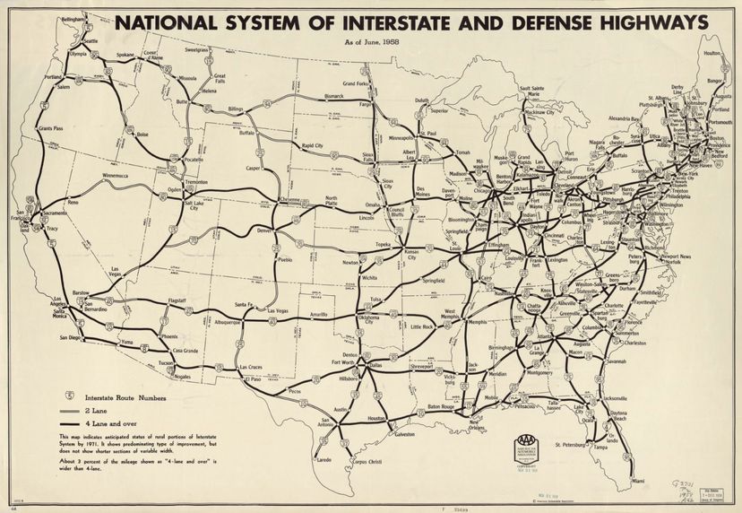
But for starters, let's find out how the Interstate Highway System began. The formal name for these roadways is The Dwight D. Eisenhower National System of Interstate and Defense Highways, and the project was approved by Congress through the Federal Aid Highway Act of 1956. It authorized the construction of about 41,000 miles (65,983 kilometers) of highways, stretching across the country from east to west and north to south.

One of the main purposes of the interstate system was national defense. President Eisenhower had served as the Supreme Commander of Allied Forces during World War II in Europe, and he'd witnessed the importance of Germany's Autobahn network, which allowed for speedy transportation throughout the country.

Another, more ominous selling point? The quick evacuation of cities that suffered potential atomic attacks.

And of course, the system was touted as a way for all Americans to travel with fewer traffic jams and more efficient routes. With no at-grade crossings (that is, intersections), the system used overpasses and underpasses to allow for seamless, stop-free, high-speed travel. There are now 46,876 miles (75,439 kilometers) of roadway with the interstate designation.

Construction began in 1956 in Missouri on what's now named I-70, but the system as a whole wasn't completed until 1992, when crews finished a devilishly difficult stretch in Glenwood Canyon, Colorado, where you'll find 40 bridges and viaducts on a single 12-mile (19-kilometer) stretch.

u.s. highway system in 1958
The national system of interstate and defense highways as it looked in June 1958.
AAA/Library of Congress, Geography and Map Division.

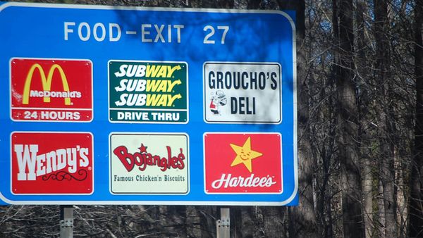
The Interstate Highway System transformed American life. The cargo trucking industry arose, gas stations and truck stops blossomed, suburbs sprung up around cities, and the concept of the "road trip" entered the national lexicon.

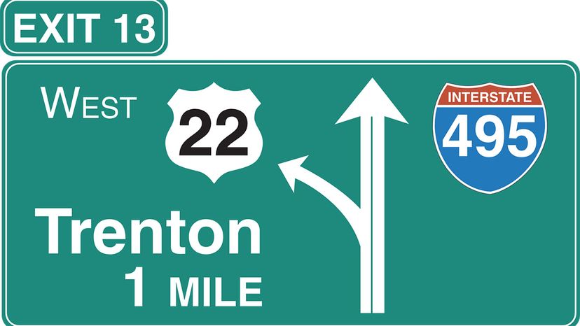
And as those road trippers zipped along, some of them surely wondered why interstates have various numbering systems. Why is one named I-5 while another is I-480? Let's take a closer look at the digits on those red, white, and blue shield-shaped signs.

Advertisement

Those Highway Numbers Aren't Random

The number of digits in the name tells you whether an interstate connects more than one city, or if it serves a single metropolitan area. Interstates with one or two digits (e.g., I-95) interconnect several regions. Those with three digits (e.g., I-285), on the other hand, are meant to serve a single city and are called auxiliary interstate highways. They connect to longer two-digit highways. The last two digits match the parent highway – for example, I-480 in Omaha is a 5-mile stretch that connects I-80 in Nebraska with I-29 in Iowa. Likewise, I-285 circles Atlanta and connects to I-85, going north and south.

Even-numbered interstates stretch east-west, while those with odd numbers move traffic north-south. Numbering for east-west highways starts in the south and moves north, so I-10 anchors the bottom border (Santa Monica, California, to Jacksonville, Florida), and I-90 is near the country's northern border (Seattle to Boston).

Advertisement

For north-south interstates, numbering begins in the west, starting with I-5, parallel to the West Coast. The easternmost interstate is I-95, running on the East Coast, from Houlton, Maine, to Miami.

There are some rare exceptions to this pattern, in cases where stretches of road were added after the first framework was already in place. For example, I-99 didn't receive its interstate designation until 1998, and it lies west of I-95 in eastern Pennsylvania.

Just two interstates split as they move through major cities. One is I-35E and I-35W in Minneapolis-St. Paul metro area; the other is I-35E and I-35W, which move through Dallas and Fort Worth, respectively.

The first digit of a three-digit interstate tips you off to its purpose. Connectors or spurs that only intersect one time mostly receive odd-numbered first digits. Even-numbered first digits, however, tend to be bypasses and loops that intersect with their parent interstate in two locations.

The names of major interstates are never repeated; they are always unique. However, some lesser stretches use the same two-digit numbers. For example, both New York and North Carolina have an I-87. There are also I-76s in both Colorado and Pennsylvania.

Three-digit interstates, however, can be used as often as necessary throughout the country, but they can't be repeated within a single state.

Advertisement

The Numerical Interstate System Can Get Messy

For instance, in San Francisco there's I-238, even though there's no I-38 for it to connect to – instead, it's an artery between I-880 and I-580. But because California already had so many roads, the appropriate digits were already in use with other roadways.

There are other exceptions, too. Alaska, Hawaii and Puerto Rico all have interstates, even though these roads don't connect to other states. They have special lettered designations: Alaska has A1 through A4, Hawaii has an H1 through H3 and Puerto Rico has a PR1 and PR2.

Advertisement

State highway naming convention differs a bit from the interstates. These roadways, which are denoted by black-and-white signs with badge symbols, use the same system of odd numbers for north-south routes, and even numbers for east-west routes. However, the number system is flip-flopped. The numbers on east-west roads get larger as you go from north to south, and the numbers on north-south highways increase as you go from east to west across the state.

Advertisement

Loading...